- EU projects
- Research
- Fish tagging
- Lumpfish research
- Oceanography
- Seabed mapping
- Arnarfjörður
- Drekasvæði
- Ísafjarðardjúp
- Jökulbanki
- Jökuldjúp
- Kolbeinseyjarhryggur and adjacent area
- Kolluáll
- Langanesgrunn
- Látragrunn
- Nesdjúp
- Reykjaneshryggur and adjacent area
- Selvogsbanki
- South of Selvogsbanki
- South of Skeiðarárdjúp
- South of Skerjadjúp
- Southeast of Lónsdjúp
- Southwest of Jökuldjúp
- Suðausturmið
- Suðurdjúp
- Vesturdjúp
- East of Reykjaneshryggur
- Vestfjardarmid
- Seal research
- Whale Research
- Advice
- About

Expedition measuring East Greenland Current
08. September 2025
 On board Thorunn Thordardottir.
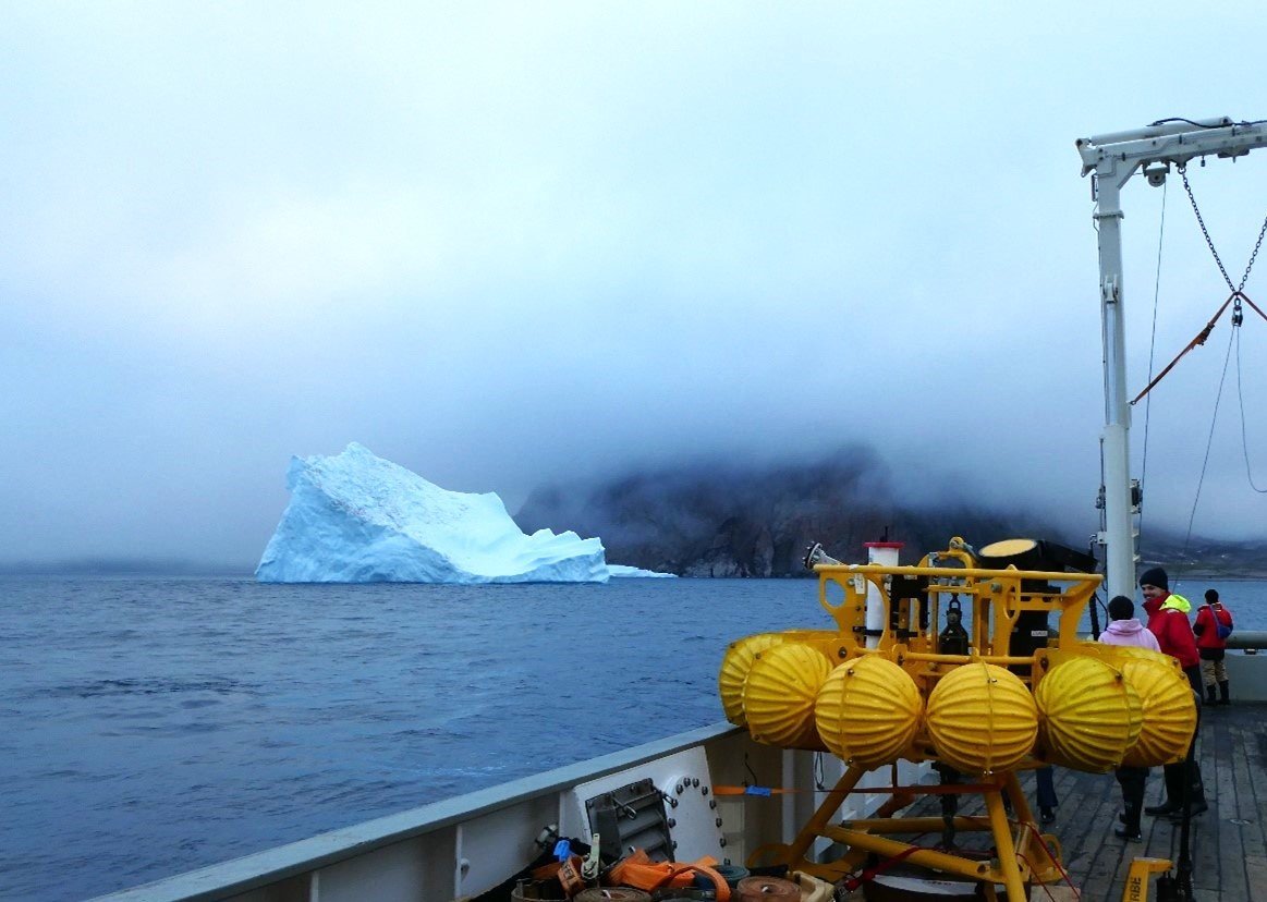
MFRI´s new research vessel Þórunn Þórðardóttir HF300 is on a charter from 29 August to 12 September for an international research project focused on the oceanography and current measurements in the East Greenland Coastal Current. The East Greenland NOrdic seas Gateway (EGNOG) project is funded by the US National Science Foundation and led by scientists Nicholas Foukal (Skidaway Institute of Oceanography), Daniel Torres (Woods Hole Oceanographic Institution), and Thomas Haine (Johns Hopkins University), in collaboration with Kjetil Våge (University of Bergen), Manuel Colombo (Virginia Institute of Marine Sciences) and Andreas Macrander (Marine and Freshwater Research Institute). On board for this cruise in total are 15 physical and chemical oceanographers from the United States, Norway, and Iceland, as well as a journalist and a photographer from the New York Times.
Measurement aim to assess impact on AMOC stability
The project aims to measure the currents and salinity of the East Greenland Coastal Current for a year with moored instrumentation at 71°N. The East Greenland coastal current carries fresh water from the Arctic and Greenland Ice Sheet southward toward the North Atlantic where it may increase stratification and slow or stop the large-scale Atlantic Meridional Overturning Circulation (AMOC). The strength and variability of this current have never been measured continuously over the course of an entire year, and the measurements of this project aim to assess its possible impact on AMOC stability.
In the ongoing expedition on Þórunn Þórðardóttir, hydrographic conditions are observed on several dozens of stations across the East Greenland Current at 71° and in Scoresbysund, using a CTD (conductivity-temperature-depth). Water samples are taken to measure various tracer elements indicating the origin of the freshwater at the different locations. Acoustic Doppler Current Profilers (ADCP) both in the keel of the vessel as well as on the CTD are employed for measuring current velocity and direction down to 1600 m depth. Finally, several current meter moorings have been deployed on the seafloor along the section at 71°N that will measure temperature, salinity and ocean currents for one year. The moorings and data will be recovered in 2026 on a Norwegian research cruise to the region.