- EU projects
- Research
- Fish tagging
- Lumpfish research
- Oceanography
- Seabed mapping
- Arnarfjörður
- Drekasvæði
- Ísafjarðardjúp
- Jökulbanki
- Jökuldjúp
- Kolbeinseyjarhryggur and adjacent area
- Kolluáll
- Langanesgrunn
- Látragrunn
- Nesdjúp
- Reykjaneshryggur and adjacent area
- Selvogsbanki
- South of Selvogsbanki
- South of Skeiðarárdjúp
- South of Skerjadjúp
- Southeast of Lónsdjúp
- Southwest of Jökuldjúp
- Suðausturmið
- Suðurdjúp
- Vesturdjúp
- East of Reykjaneshryggur
- Vestfjardarmid
- Seal research
- Whale Research
- Advice
- About

Seabed mapping
Seabed mapping is one of the Marine and Freshwater Research Institute´s projects which started with the launching of the research vessel, Arni Fridriksson RE 200, in the year 2000. The vessel is equipped with a multibeam echo sounder which enables a detailed mapping of the seabed. Until spring 2017 the multibeam echo sounder was of the type Kongsberg EM 300 (30 kHz, 135 beams, 2°x2°) but was then updated to Kongsberg EM 302 (30 kHz, 432 beams, 1°x2°, water column data) and a subbottom profiler, Kongsberg TOPAS PS18.
From the year 2017 the seabed mapping project is one of MFRI´s major initiatives for the next 12 years. The main emphasis is to gain information within the economic zone which is useful for multifaceted purpose and is a prerequisite for scientific approach for sustainable utilization, protection and research of resources in the ocean, on, in and under the seabed. The detailed mapping has been valuable for the research of the marine environment, the physical properties of the ocean and the marine geology. Mapping fishing grounds and vulnerable areas, i.e. benthic communities and habitats, has played a significant role.
Any use of maps or data from this website shall be cited to its origin.
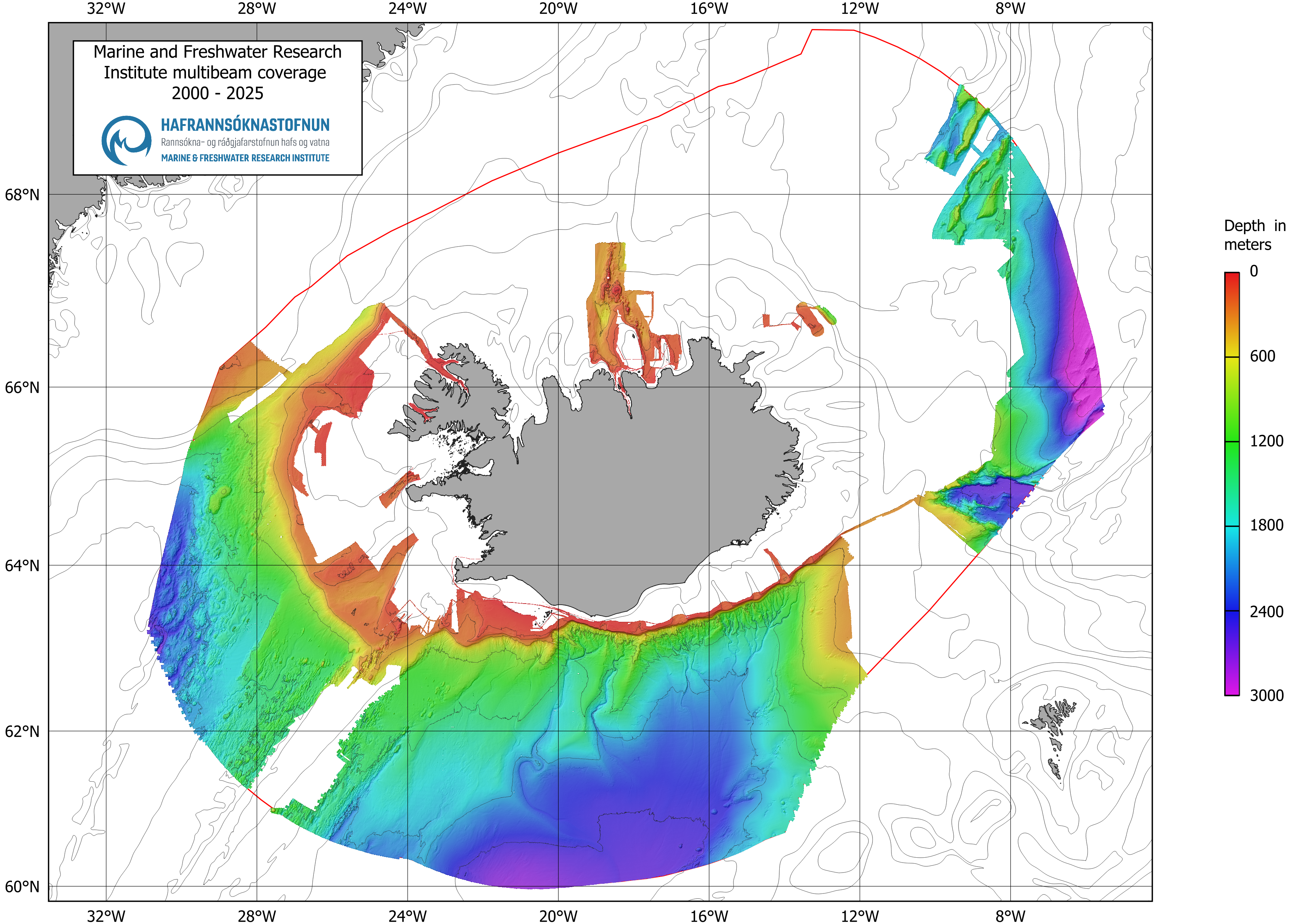
The image shows an overview of MFRI's seabed mapping with multibeam measurements in the years 2000-2025.