- EU projects
- Research
- Fish tagging
- Lumpfish research
- Oceanography
- Seabed mapping
- Arnarfjörður
- Drekasvæði
- Ísafjarðardjúp
- Jökulbanki
- Jökuldjúp
- Kolbeinseyjarhryggur and adjacent area
- Kolluáll
- Langanesgrunn
- Látragrunn
- Nesdjúp
- Reykjaneshryggur and adjacent area
- Selvogsbanki
- South of Selvogsbanki
- South of Skeiðarárdjúp
- South of Skerjadjúp
- Southeast of Lónsdjúp
- Southwest of Jökuldjúp
- Suðausturmið
- Suðurdjúp
- Vesturdjúp
- East of Reykjaneshryggur
- Vestfjardarmid
- Seal research
- Whale Research
- Advice
- About

Seabed mapping in full swing
18. April 2024
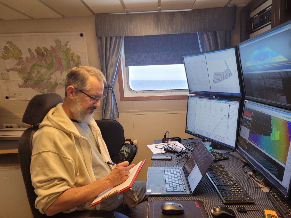 Julian Burgos, marine ecologist, monitoring the acquisition of data
The thirteenth multibeam survey of the Marine and Freshwater Research Institute’s to map the seabed around Iceland.
Seabed Mapping project began 9 April, departing from the Westman islands en route to the west of the Reykjanes Ridge, the survey covered Reykjanesgrunn, Faxabanki, and Jökuldjúp. Despite challenging conditions, including strong north-northwest winds, the team managed to obtain satisfactory depth measurements of the seabed, covering an area of approximately 5996 km2 by the time of this report.
Currently, measurements are being conducted to the west of Jökulbanki, and they are yielding promising results (figure 1 - see figures below). This region's seabed features the insular slope, characterized by slumps, turbidity currents, channels, and fault scarps (figure 2 and 3). Of notable geological interest is the northeast-southwest ridge, reaching heights of around 450 meters, which traverses the entire area before abruptly terminating near the shelf at 27.25° W (figure 4).
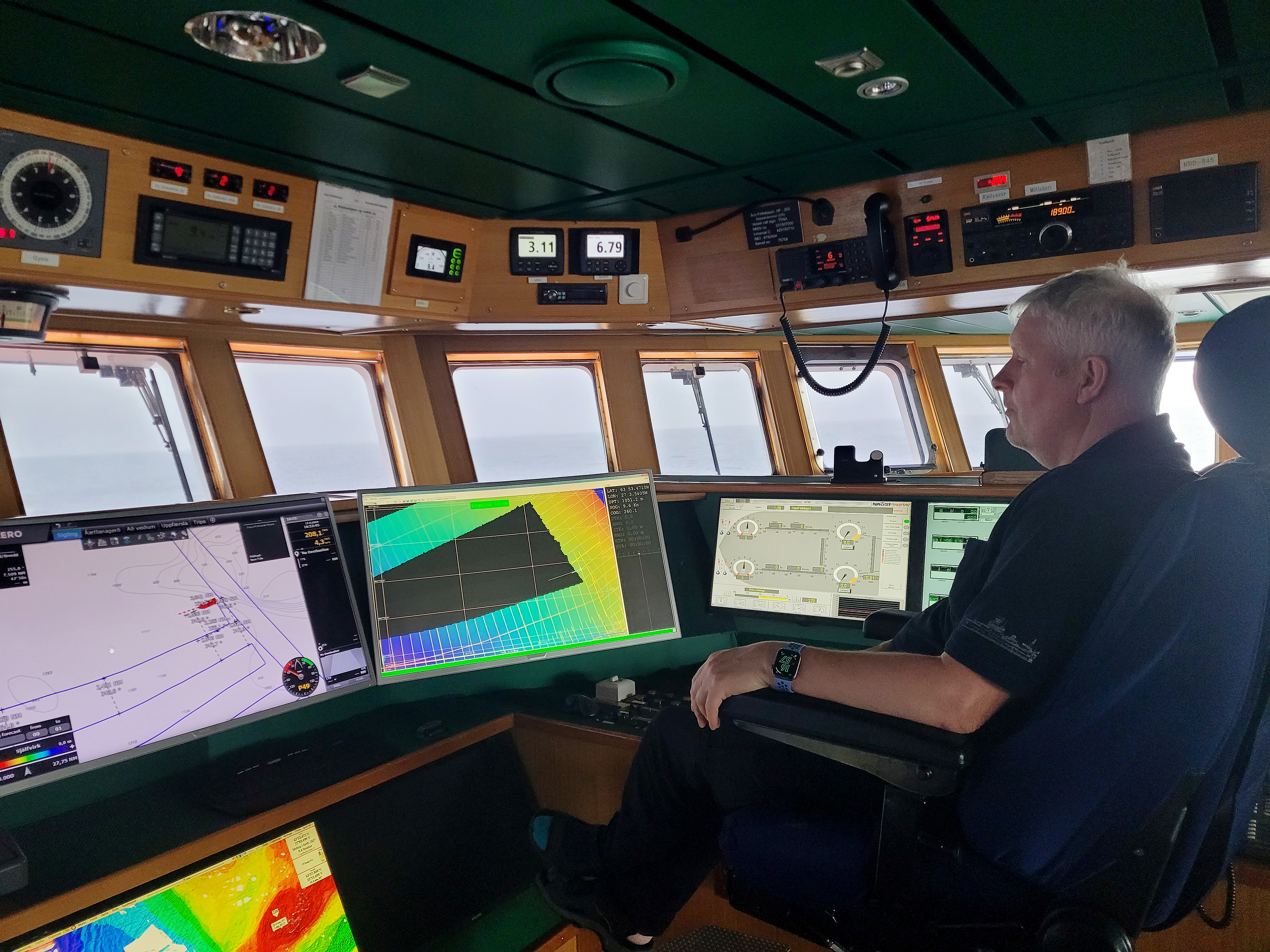
Ólafur P. Steingrímsson, first officer, at the bridge
The oceanic crust in this vicinity likely dates back 13 to 15 million years, and it is overlaid with thick sedimentary deposit. There is evidence of significant volcanic activity, including seamounts, ridges, and cones (figures 5 and 6), akin to those initially identified by the Marine Research Institute using multibeam echosounder technology in 2009 in Keiludjúp (figure 7). This volcanic activity likely coincided with the activity of the Westfjords rift zone approximately 15 million years ago (Benediktsdóttir, 2012; Sæmundsson, 1974)
The insights provided here are drawn from the A200907 cruise report authored by Guðrún Helgadottir:
“In 2009, an area spanning 2700 km2 of previously uncharted fishing grounds was mapped, primarily to conclude the mapping of Nesdjúp, one of the nation's most productive fishing grounds. During the last two days of the expedition, June 18-19, 2009, attention turned to the area now known as Keiludjúp (figure 7). The decision to explore this region was influenced by reports from a Halibut fisherman who had described "spear-like" formations on the seabed, prompting further investigation. Subsequent surveys confirmed the existence of these features at depths ranging from 900 to 1300 meters, situated at the base of the insular shelf approximately 100 nautical miles west-southwest of Snæfellsnes. The discovered cones reach heights of 40 to 200 meters. Additionally, a 450-meter-high mountain with a relatively flat crater was identified on the northern perimeter of the survey area.”
Click on pictures for a bigger view:
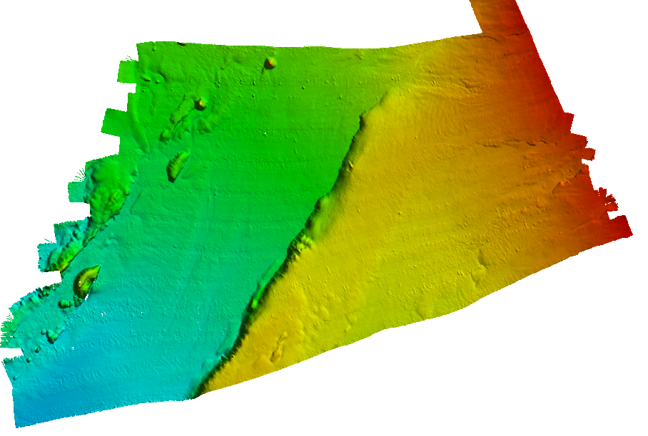
Figure 1. Overview of the survey area west of Jökulbanki, A202404
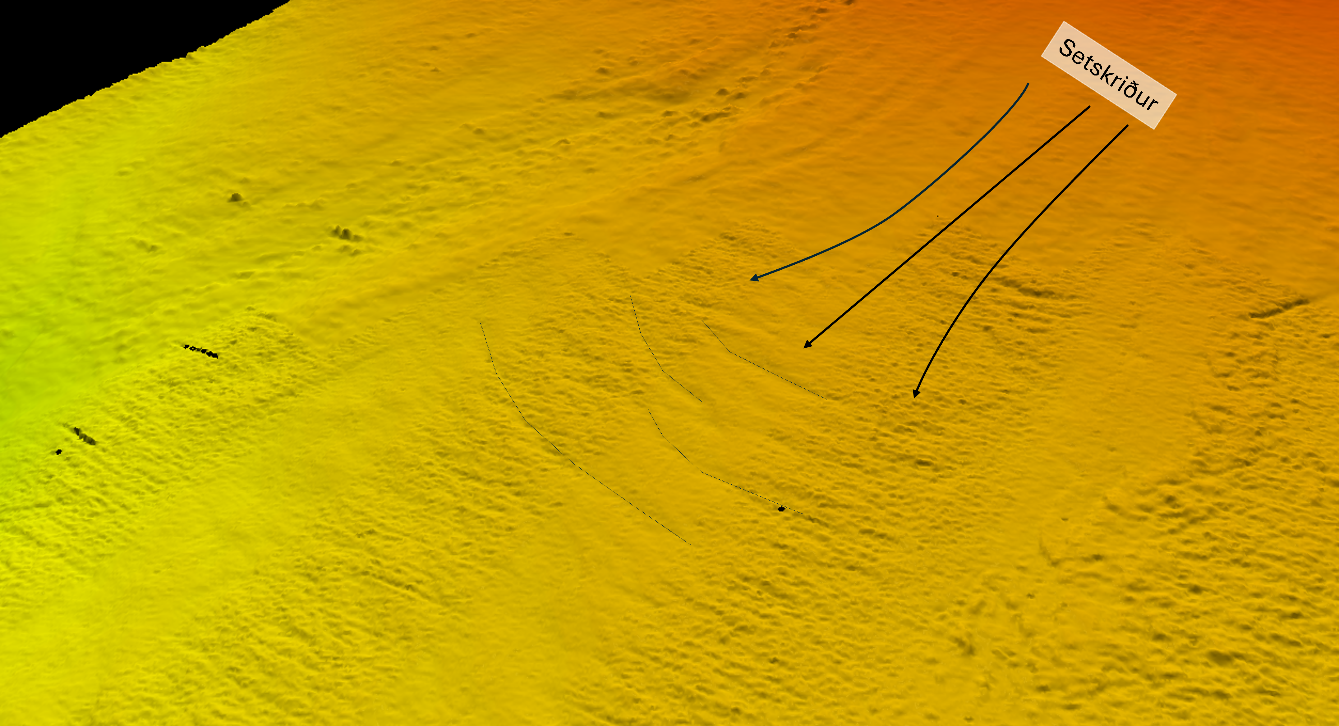
Figure 2. slump features
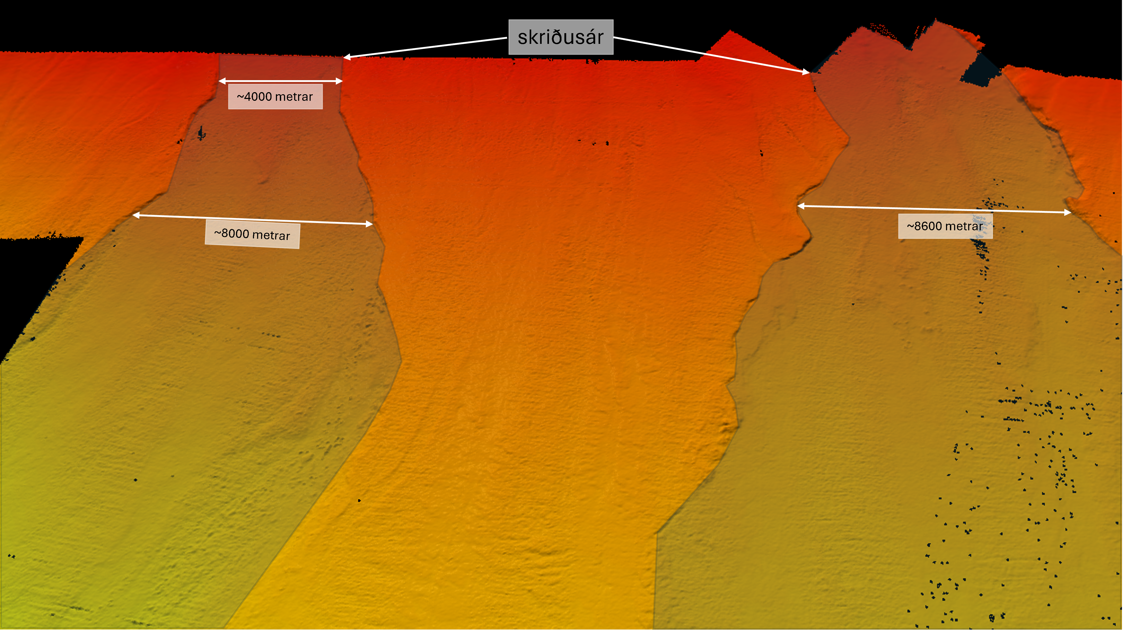
Figure 3. large scale fault scarps in the insular slope
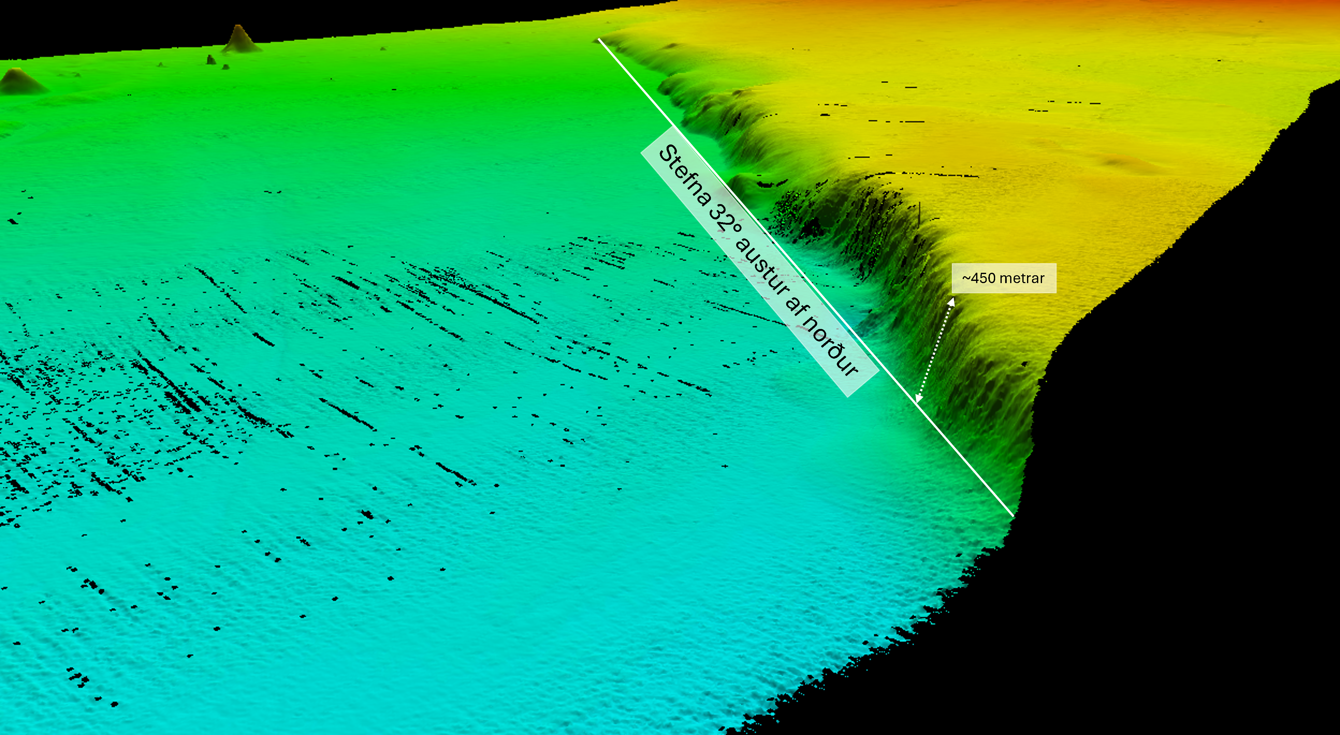
Figure 4. Northeast – southwest ridge
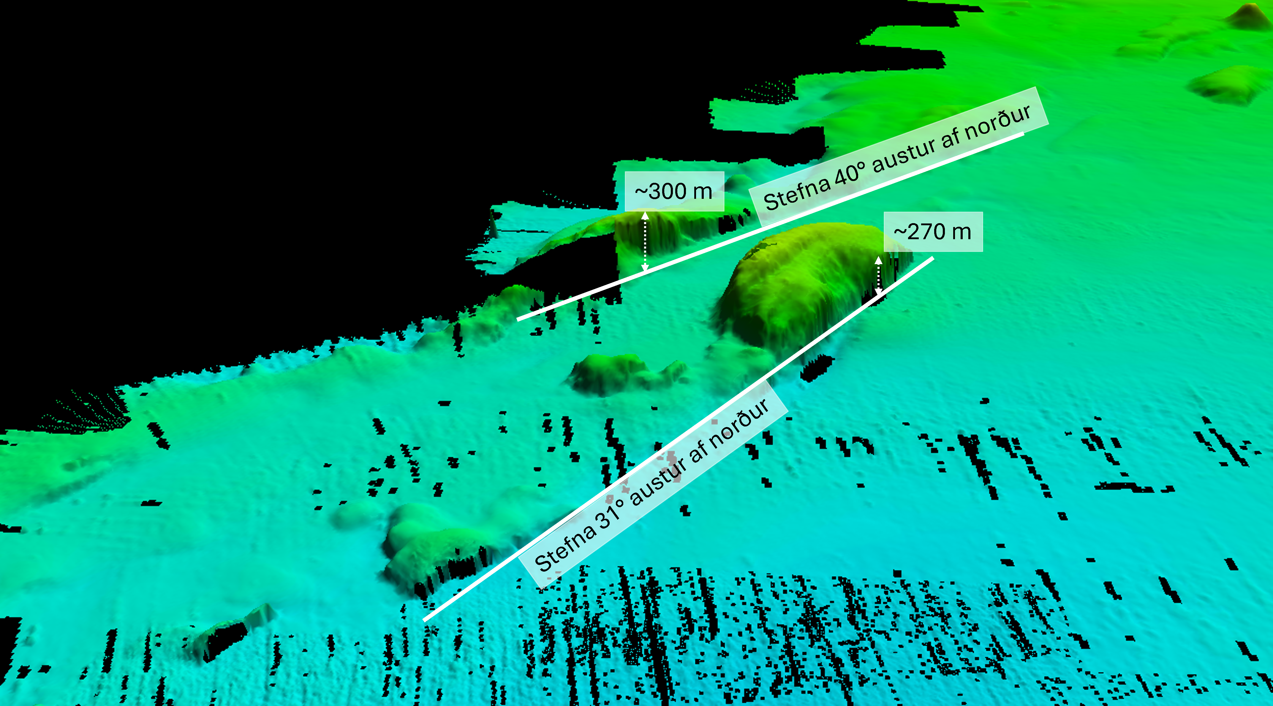
Figure 5. Seamounts and ridges
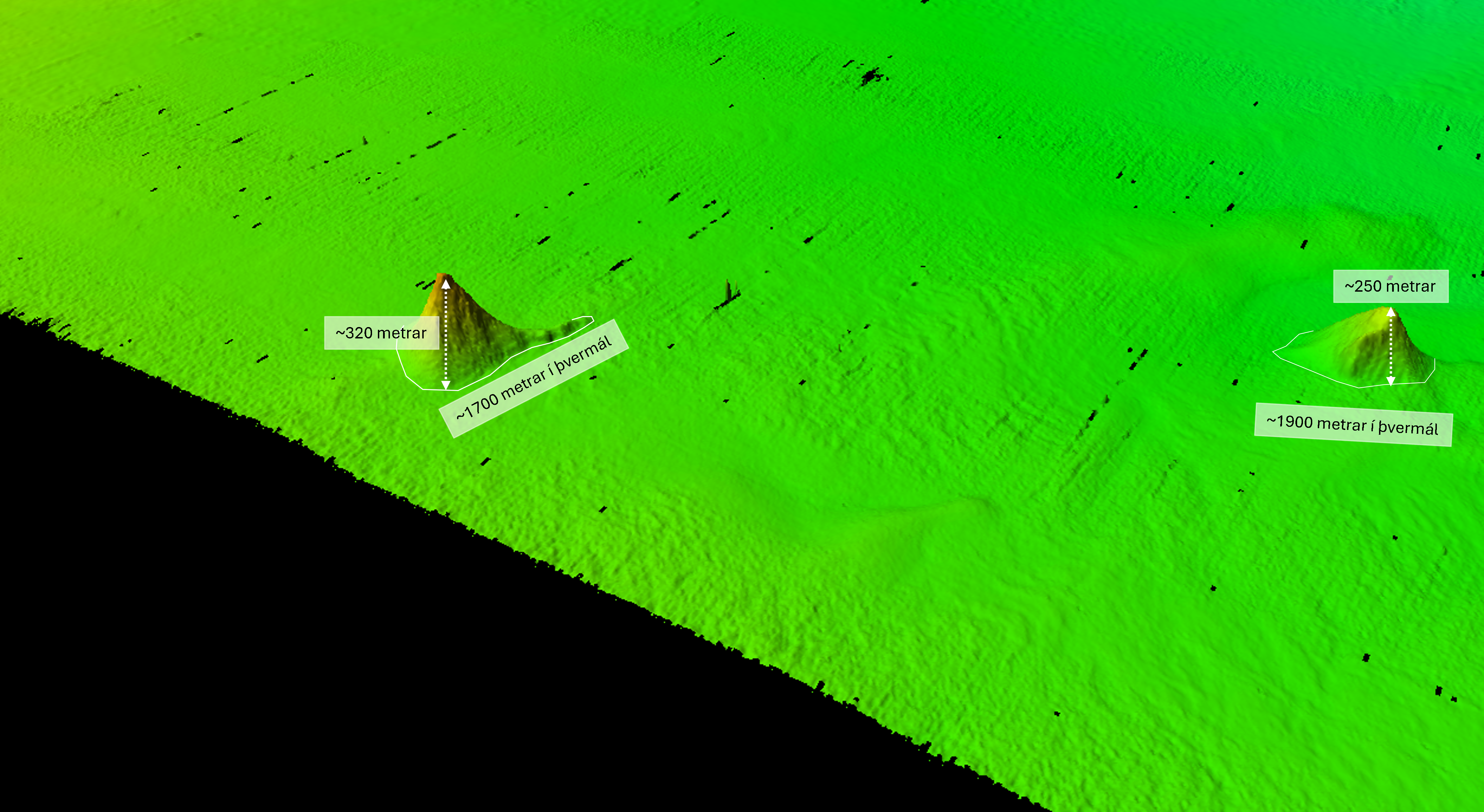
Figure 6. Cone volcanoes
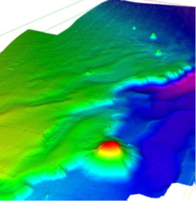
Figure 7. Overview of the survey area from Keiludjúp, A200907
Video 1. Mapping progress west of Jökulbanki 14.04 – 17.04
References:
Benediktsdóttir, Á., Hey, R., Martinez, F., & Höskuldsson, Á. (2012). Detailed tectonic evolution of the Reykjanes Ridge during the past 15 Ma. Geochemistry, Geophysics, Geosystems, 13(2). https://doi.org/10.1029/2011GC003948
Helgadóttir, G. (2009). Fjölgeisladýptarmælingar í Nesdjúpi og á djúpslóð vestur af Snæfellsnesi á rs. Árna Friðrikssyni RE 200 sumarið 2009 (Cruise report A200907). Hafrannsóknastofnun.
Sæmundsson, K. (1974). Evolution of the axial rifting zone in northern Iceland and the Tjornes fracture zone, Geol. Soc. Am. Bull., 85(4), 495–504.